
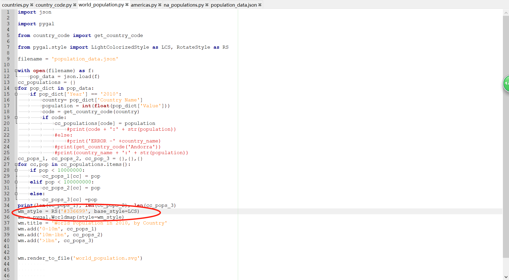
import json
import pygal
from country_code import get_country_code
from pygal.style import LightColorizedStyle as LCS, RotateStyle as RS
filename = 'population_data.json'
with open(filename) as f:
pop_data = json.load(f)
cc_populations = {}
for pop_dict in pop_data:
if pop_dict['Year'] == '2010':
country= pop_dict['Country Name']
population = int(float(pop_dict['Value']))
code = get_country_code(country)
if code:
cc_populations[code] = population
#print(code + ':' + str(population))
#else:
#print('ERROR -' +country_name)
#print(get_country_code('Andorra'))
#print(country_name + ':' + str(population))
cc_pops_1, cc_pops_2, cc_pop_3 = {},{},{}
for cc,pop in cc_populations.items():
if pop < 10000000:
cc_pops_1[cc] = pop
elif pop < 100000000:
cc_pops_2[cc] = pop
else:
cc_pops_3[cc] =pop
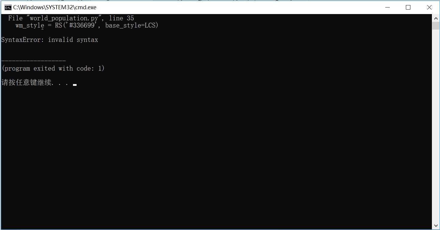
print(len(cc_pops_1), len(cc_pops_2), len(cc_pops_3)
wm_style = RS('#336699', base_style=LCS)
wm = pygal.Worldmap(style=wm_style)
wm.title = 'World Population in 2010, by Country'
wm.add('0-10m', cc_pops_1)
wm.add('10m-1bn', cc_pops_2)
wm.add('>1bn', cc_pops_3)
wm.render_to_file('world_population.svg')


